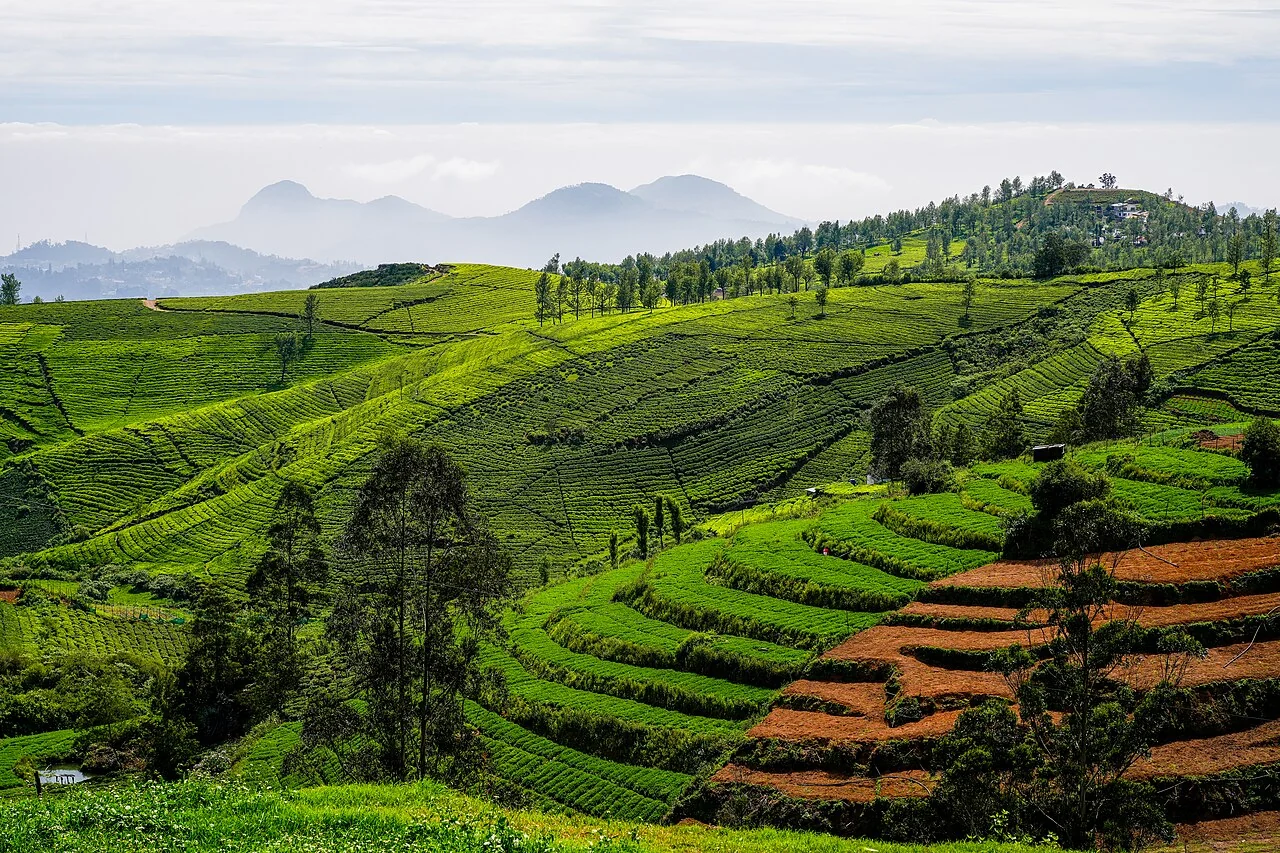
Start with the operational question
Review drainage paths, rainfall, standing-water observations, and changes in the tea canopy. Inspect both the affected area and the upstream structures that might influence it.
Separate observation from explanation
Canopy moisture indicators are not measurements of soil drainage capacity. Similar foliage symptoms can reflect root damage, nutrients, shade, or a recently altered plucking cycle.
Connect the canopy signal to the water system
Draw a simple picture of the water system: rainfall, irrigation delivery, storage, runoff, drainage, soil conditions, and crop use. Identify which parts are measured and which are modelled or inferred. An observation of standing water, a soil-moisture reading, and a canopy moisture-related index describe different parts of that system and should retain their own units and dates.
Plan field checks around contrasts that could test the proposed explanation. Inspect upstream and downstream locations, irrigation heads and tails, different soil or terrain positions, and areas with similar crops but different symptoms. Record recent rainfall and operations. If a sensor is used, document placement, depth, maintenance, calibration information, and whether it represents the surrounding field.
Use imagery to organise investigation and monitor patterns over suitable dates. A map alone should not become a universal irrigation amount or drainage instruction. Local agronomy, system capacity, safety, and environmental requirements shape the response. After an intervention, record what was done and compare later observations while acknowledging weather and management changes that may also explain the outcome.
Read article: Tea pruning-cycle records and satellite interpretation
Treat pruning history as essential map context
Tea monitoring should begin with a block register that includes cultivar or planting material where known, planting age, pruning history and the current plucking cycle. Tea is managed for repeated vegetative harvest, so canopy changes can reflect planned operations as well as unwanted stress. A recently pruned block should not be ranked against a block with a developed plucking surface without explaining the difference. Retain those management classes in tables, map legends and field forms.
TNAU's tea guidance discusses well-drained soils, organic matter, pruning and plucking as parts of the production system. These topics identify useful observations; they do not establish universal treatment rates for every tea-growing region. Record slope position, drainage condition and visible soil exposure alongside crop observations. On hillsides, shadow and illumination can change the appearance of adjoining rows, so compare image patterns with terrain and the direction of sunlight before assigning a biological interpretation.
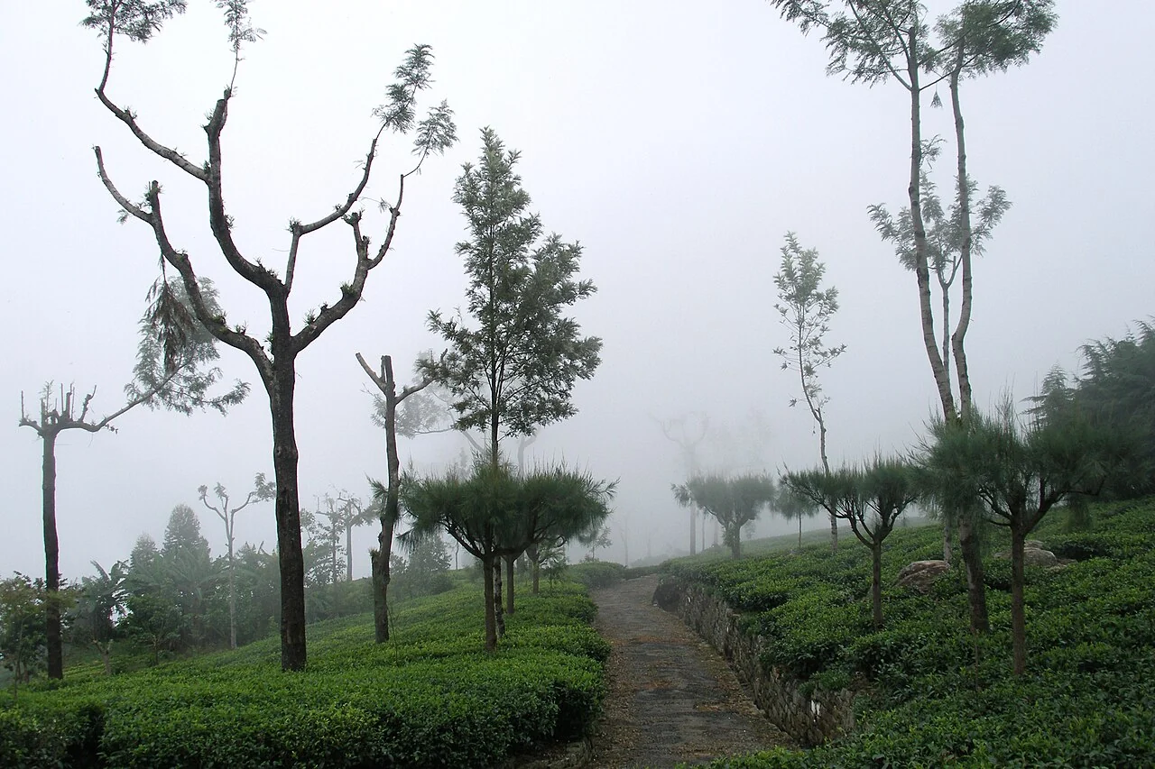
Use field observations that explain the plucking surface
A field visit can document shoot condition, canopy continuity, gaps, weeds and the recent management operation at each sampled location. Define the observation unit and use it consistently: a photograph of one bush and a judgement about an entire block are different scales of evidence. Select both apparently normal and affected places within comparable pruning and plucking situations. Record the date and time because harvesting activity may change the surface between an image acquisition and the visit.
Where the concern is moisture or drainage, inspect the ground and access routes as well as the leaves. A canopy signal alone cannot distinguish inadequate water supply from poor root conditions or another constraint. Where the concern is nutrition or disease, use an agreed sampling or diagnostic procedure and retain the resulting laboratory or specialist record. Avoid converting a colour class into a fertiliser amount or plant-protection recommendation without the necessary agronomic evidence.
Connect the field map to operations and quality records
Repeated harvesting makes the timing of a comparison particularly important. Keep plucking dates, relevant labour or machine operations and collected leaf quantities associated with the correct block and reporting period. If a factory intake combines leaf from several blocks, preserve the aggregation rule instead of presenting the intake as a measurement of one small mapped patch. Tea quality also involves harvesting and processing decisions that are not visible in a satellite image.
For the next monitoring cycle, revisit the same observation locations and note changes in pruning status, canopy development and drainage. Evaluate whether an alert correctly identified a place needing inspection and whether the follow-up produced useful evidence. A stable colour pattern can be operationally important even when its cause remains uncertain; an abrupt change can be routine if it coincides with a documented intervention. Publish the event history with the map so managers can distinguish those situations and plan the next inspection deliberately.
Design reference observations that represent the field
State the population that the sample should represent and the question it must answer. Select locations across relevant crop stages, terrain, management, and image conditions. Include ordinary areas and difficult cases, not only conspicuous anomalies or convenient roadside stops. Record selection rules so that later users understand where the reference is representative.
Define the observation unit, area or depth, timing, instrument or laboratory method, and required replicates using the appropriate discipline's protocol. A point observation and a satellite pixel have different spatial support. Record enough context to evaluate that mismatch. Keep inaccessible sites in the sampling log and explain any replacement rather than silently dropping them.
Separate reference collection from the result being evaluated when feasible. Review observer consistency and missing data before calculating agreement or error. Retain raw observations, corrections, and exclusions with their reasons. More samples can improve precision, but a large biased sample still fails to represent excluded conditions. Use the results within the population and period that the sampling design supports.
Read article: Tea field-access planning on steep terrain
Read a time series as dated evidence
Keep the actual acquisition dates and the usable observation count. Plot management events beside the series and inspect gaps instead of allowing a smooth line to imply continuous measurement. A composite or interpolated value should be labelled with its method and temporal support. It may summarise several dates rather than describe one moment.
Compare similar crop stages and management histories. Align by planting, cutting, pruning, or another relevant event when calendar dates would mix different stages. Check that the field boundary, sensor treatment, scale factors, and quality rules are consistent. A processing or geometry change can create a break that has no biological cause.
Examine the original imagery around unusual points and seek corroboration from another usable observation or the field record. Distinguish persistent changes from single-date outliers. Report the period that can actually be observed and avoid estimating an event date more precisely than the data support. Preserve uncertainty around cloudy intervals or periods with no suitable ground reference.
Define the deliverable and approval
Prepare a wet-area inspection route with dated evidence, drainage connections, and a maintenance follow-up process that records whether the observed condition changed.
A practical review before sharing the result
Check the observation against its source and make sure the field identifier is correct. Review dates, units, missing values, quality exclusions, and geometry versions. Ask a colleague to reproduce one representative result from the recorded inputs. This small independent check often exposes a misunderstood field code or a processing assumption before it affects an entire report.
Write down the alternative explanations for the mapped pattern and identify what evidence would distinguish them. Keep a measured observation separate from the interpretation and from any treatment or management instruction. A decision should name its responsible reviewer and account for local operating procedures. If the evidence is insufficient, the appropriate output is a targeted inspection rather than a confident claim.
Keep the original result, any reviewed version, and a short change log. State which locations and periods the output can reasonably describe. When sharing a map, provide a clear legend, source dates, and an accessible explanation of uncertainty. The recipient should know whether a feature is a confirmed observation, a candidate awaiting inspection, or a model-based estimate.
Read article: Tea plucking-table monitoring from aerial imagery
Turn the investigation into a repeatable field cycle
Prepare the visit with a map that can be used at the intended location and a concise list of questions. Confirm access, permissions, equipment, and the availability of a person familiar with the field. Choose representative stops as well as unusual areas. Record where the planned route could not be followed, because missing observations can change how the result should be interpreted.
After the visit, review the observations while the team can still clarify them. Connect photographs, measurements, and comments to the same field and visit identifiers. Assign a follow-up status and preserve unresolved cases. A correction should explain what changed and why; it should not erase the original evidence or make an earlier interpretation appear to have been certain.
At the next suitable observation date, compare conditions using the same definitions and review any management or weather events that occurred between visits. Record the action actually completed and its operational outcome. This creates an evidence trail from an initial pattern to field confirmation and later review, making the mapping process easier to improve over successive seasons.
Connect this work with AgroSensing
Use a connected spatial workflow to organise imagery, commodity records, and geolocated field observations. Discuss the appropriate data, validation, and operating scope with the team.
Sources and further reading
The linked primary references explain the underlying agronomic and geospatial concepts. The field workflows in this guide are editorial recommendations to adapt with the responsible local specialist.